
Tijuana experiences seismic activity due to its geological positioning. The city is located along the Pacific Ring of Fire. Tijuana sits on the border between the North American Plate and the Pacific Plate, making it susceptible to earthquakes.
Tijuana does experience seismic events, although less frequently. The geological landscape of Tijuana is characterized by the complex interaction of tectonic plates. The North American Plate extends beneath much of Mexico, while the Pacific Plate borders the western coast.
The boundary where these plates meet is known as the San Andreas Fault, which extends from California through Baja California, near Tijuana. This fault line is a primary source of seismic activity in the region.
Earthquakes in Tijuana result from the movement and interaction of these tectonic plates. When stress accumulates along fault lines, it can lead to sudden releases of energy, causing the ground to shake.
While the frequency and intensity of earthquakes in Tijuana may not rival those experienced in more seismically active areas, such as California or Japan, they still pose risks to the region’s inhabitants and infrastructure.
Several factors contribute to the variability of seismic activity in Tijuana:
- The San Andreas Fault is not the only fault line in the area.
- Fault systems, such as the Laguna Salada Fault and the Cerro Prieto Fault, also influence seismicity.
- The depth and direction of fault movement can vary, affecting the magnitude and distribution of earthquakes.
Moreover, the geological composition of the region plays a role. Tijuana’s proximity to the coast exposes it to potential tsunamis triggered by underwater earthquakes. While these events are relatively rare, they add another layer of risk to the city’s seismic profile.
The seismic hazard in Tijuana underscores the importance of preparedness and mitigation measures. Building codes and construction practices must account for the threat of earthquakes to minimize damage and protect lives. Furthermore, public awareness and education initiatives can help communities understand the risks associated with seismic activity and take proactive steps to enhance resilience.
Understanding the geological dynamics of the area, including its position along tectonic plate boundaries and the presence of fault lines, is essential for comprehending why earthquakes occur in Tijuana. By acknowledging these factors and implementing appropriate measures, residents and authorities can mitigate the impact of seismic activity on the city and its inhabitants.
Notable Earthquakes in the Tijuana Area
One of the most notable earthquakes in the Tijuana area occurred on February 9, 1892.
This seismic event, known as the Rosarito earthquake, had an estimated magnitude of 7.2. The epicenter was located near the coastal town of Rosarito, approximately 25 kilometers south of Tijuana. The earthquake caused significant damage throughout the region, with reports of collapsed buildings and infrastructure.
Although seismic monitoring and recording were not as advanced at the time, historical accounts indicate that the earthquake had a profound impact on communities in the Tijuana area, highlighting the seismic vulnerability of the region.
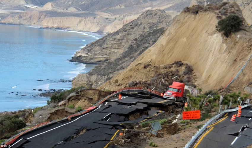
Another significant earthquake in the Tijuana vicinity occurred on April 4, 2010.
This earthquake, with a magnitude of 7.2, originated near the city of Mexicali, which is approximately 175 km east of Tijuana. While Tijuana did not experience the full brunt of the earthquake’s intensity, the event was widely felt throughout the region, including in Tijuana and surrounding areas.
The earthquake caused structural damage to buildings and infrastructure, including roads and bridges. Fortunately, there were no reports of fatalities in the Tijuana area, but the event served as a reminder of the seismic hazard posed by the nearby fault systems.
These earthquakes underscore the seismic risk faced by the Tijuana area due to its proximity to active fault lines, such as the San Andreas Fault and the Cerro Prieto Fault.
While seismic events of such magnitude are relatively rare, they serve as important reminders of the need for preparedness and mitigation efforts to minimize the impact of future earthquakes on the region’s communities and infrastructure. These earthquakes contribute to ongoing scientific research aimed at understanding seismic activity in the Tijuana area and improving earthquake forecasting and mitigation strategies.